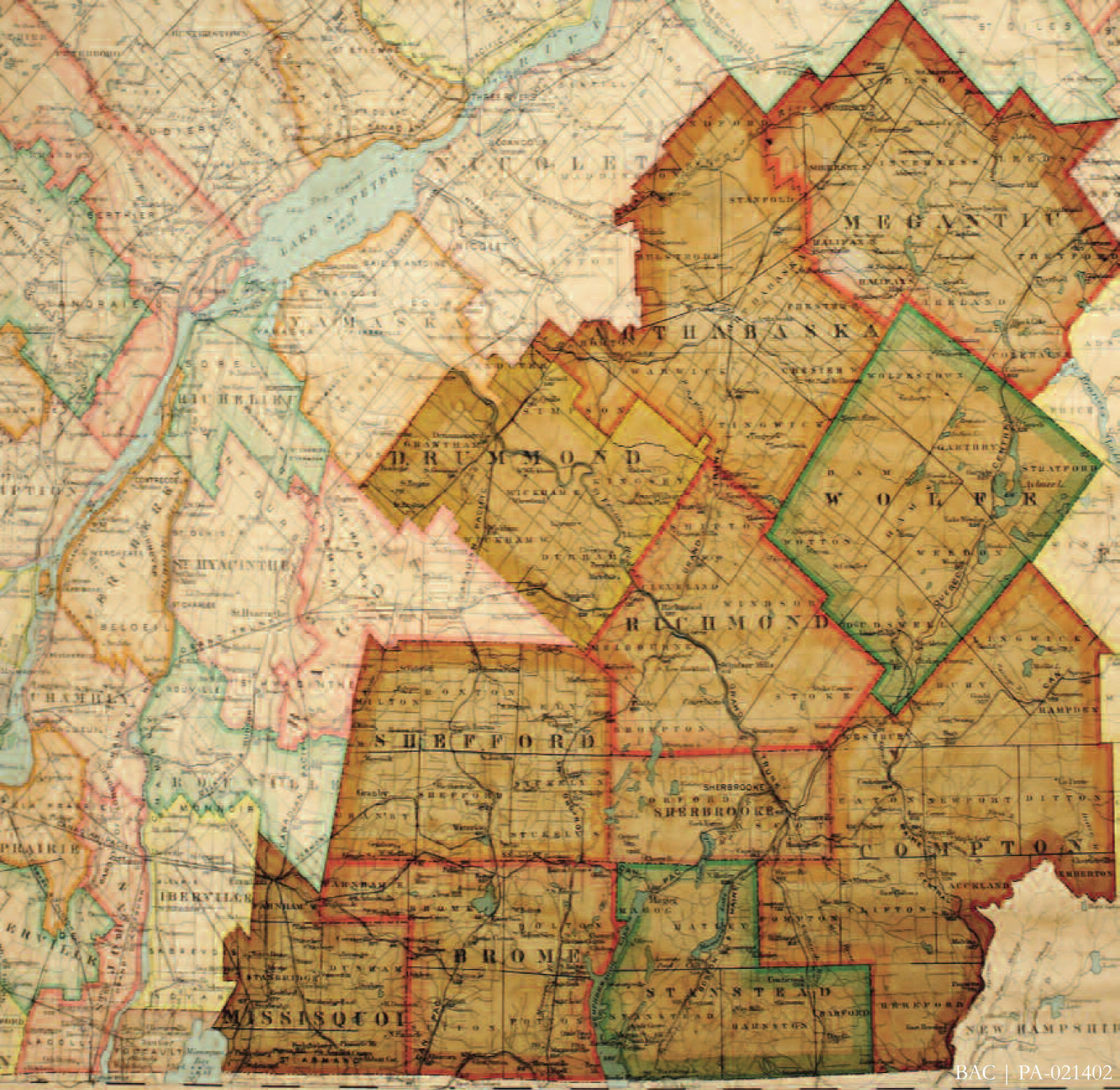
Cette carte datant de 1912 illustre les Cantons-de-l’Est d’antan. Bien que la toponymie et les frontières aient évolué au fil des années, onze comtés et plus de quatre-vingt-dix cantons ont été établis, la majorité nommés d’après les lieux dans les îles Britanniques.
Aujourd’hui le territoire qui constituait les Cantons-de-l’Est est divisé en plus d’une douzaine de municipalités régionales de comté (MRC), au sein de la région administrative de l’Estrie, de même qu’à l’intérieur de parties de trois autres régions : la Montérégie, le Centre-du-Québec et Chaudière-Appalaches.
This 1912 map shows the historical Eastern Townships. Although the toponymy and boundary lines changed over the years, eleven counties and more than ninety townships were established, the majority named after place names in the British Isles.
Today the territory that constituted the Eastern Townships is divided into more than a dozen regional governments, known as Municipalités régionales de comté (MRCs), within the administrative region of Estrie as well as within parts of three other regions: Montérégie, Centre-du-Québec, and Chaudière-Appalaches.
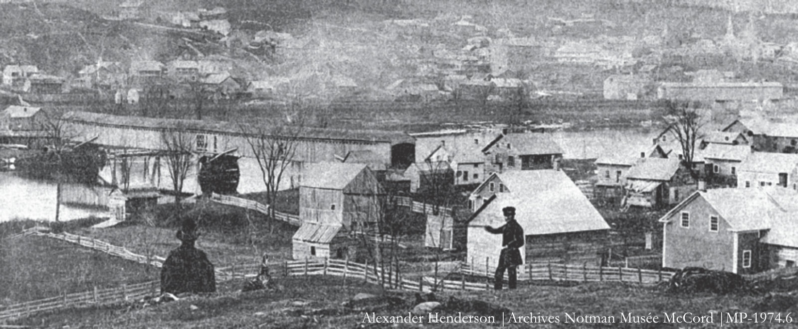
Pont Aylmer | Pont du chemin de fer du Grand Tronc
Dans le passé, plusieurs ponts couverts traversaient la rivière Saint-François. La photo d’Alexander Henderson, prise en 1858, nous présente le pont Aylmer (à gauche) au niveau de la rue King, à Sherbrooke (Comté de Sherbrooke), et le pont du chemin de fer du Grand Tronc.
Historically, several covered bridges crossed the St. Francis River. Alexander Henderson’s 1858 photo shows the Aylmer Bridge (left) at King Street in Sherbrooke (Sherbrooke County) and the Grand Trunk Railway bridge.
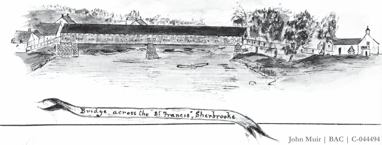
Pont sur la rivière St-François | Sherbrooke
John Muir, en 1878, a peint l’un des ponts de Sherbrooke au cours d’une expédition d’arpentage pour le chemin de fer du Grand Tronc, de Portland (Maine) à Montréal.
John Muir painted one of the Sherbrooke bridges while on a Grand Trunk Railway survey party from Portland, Maine, to Montreal in 1878.
John Muir a peint le pont de Richmond (Comté de Richmond) en 1878.
John Muir painted the Richmond Bridge (Richmond County) in 1878.
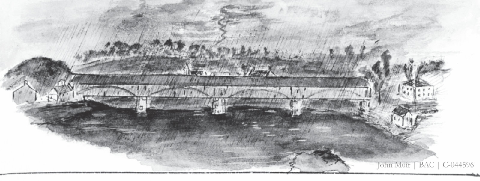
Pont de Richmond
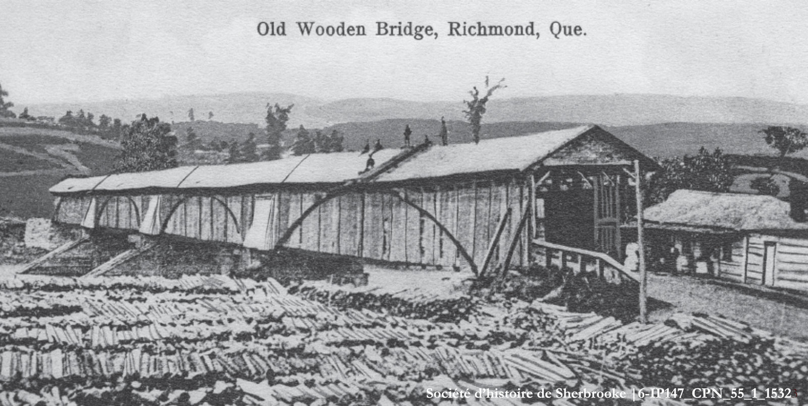
Pont de Richmond
Le pont de Richmond a été construit dans un style architectural qui incorporait des arcs pour permettre d’allonger la portée des ponts. Ce style a été mis au point en 1804 par l’Américain Theodore Burr. Le pont a été démoli en 1882.
The Richmond Bridge was built in an architectural style that incorporated arches and was invented in 1804 by American Theodore Burr to allow longer spans for bridges. The bridge was demolished in 1882.