Une condition essentielle à toute pénétration de la colonisation fut l’ouverture de chemins carrossables. Ceux-ci allaient permettre l’accès aux sites habités, les échanges commerciaux et le transport des matériaux exploités. II est remarquable de constater combien rapide fut le développement du réseau routier, d'un service de traversiers sur le lac Memphrémagog et des chemins de fer.
Les routes
Nicholas Austin se vit octroyer le canton de Bolton en 1792 et la construction d'un chemin traversant le canton du sud au nord jusqu'à Bolton, une distance d'environ 18 km. Une carte de Joseph Bouchette de 1805 décrit ce chemin ainsi qu'un autre partant de la Pointe Gibraltar en direction ouest vers Bolton. En 1800, une carte par Duberger indique une route venant de North Troy (Vermont) passant au sud de Potton et se dirigeant vers l’ouest à travers le canton de Sutton en direction de la seigneurie de St-Armand. En 1839 une carte militaire du Col. Charles Gore illustre les grands axes routiers de l’époque soit la route Leadville-Mansonville-West Potton et la route nord-sud, la 243 actuelle.
Sur la carte de Gore, on note que l’emplacement de Mansonville est indiqué par "Manson's Bridge" et sur une autre carte militaire de 1863 le chemin Leadville s'appelle "King's Highway". II faut apprécier le contexte militaire des premiers chemins à une époque où le Canada a vécu en 1812-13 sous la menace des États-Unis. Plus tard, c'est la Rébellion de 1837-38 qui a eu ses répercussions jusqu'ici suscitant de la sympathie chez les voisins du Sud. II y eut quelques incursions dans Potton où s'organisa une petite milice appelée "Potton Guard" sous le commandement de Thomas Guilman qui se servit de la Place Manson comme terrain de parade. On pouvait aussi compter sur une escouade à cheval pour la patrouille.
II y avait une très longue frontière à protéger et il était essentiel d'avoir des cartes militaires de la région pour permettre aux armées d'aller défendre les points stratégiques de la frontière en cas d'attaque. Or justement, la route venant de l’ouest permettait l’arrivée de soldats des garnisons de St-Jean et du Fort Lennox sur le Richelieu.
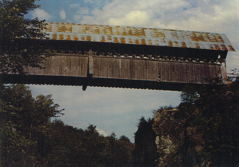
Enfin, la carte de 1863 et celle de 1881 (Annexe 1) illustrent l’ensemble des routes de l’époque qui totalisaient environ 190 km (114 mi) à comparer à aujourd'hui où ce réseau se limite à environ 155 km (93 mi). Ce qui est remarquable ici est de noter que le réseau routier de Potton avec de nombreux ponts était à peu près complété en 1839 (carte de Gore) avant même l’établissement d'un gouvernement municipal et alors que la population totale du canton atteignait à peine 800 personnes. De plus, selon une étude de Tremblay (1986), au milieu du 19e siècle, il n'y avait pas d'ouvriers spécialisés pour la construction. Comment a-t-on pu construire chemins et ponts avec si peu de ressources?
Before any colonization could take place, roads had to be built so that people could reach their lots by animal drawn carts. Roads would also promote business exchanges and the movement of goods and materials. With remarkable speed the road network, ferry services on the Lake and, later, railways developed.
Roads
The Land Committee granted Nicholas Austin land in Bolton Township in 1792 and a road from the U.S. border to Bolton was built that year, a distance of about 18 km (11 mi). Joseph Bouchette's map of 1805 describes this road as well as another leaving from Gibraltar Point in the direction of the Bolton Pass to the west. In 1800, another map, this one by Duberger, shows a road coming from North Troy and heading through the south of Potton towards Sutton and St. Armand. In 1839, a military map by Col. Charles Gore depicts the main roads: Leadville-Mansonville-West Potton and the other, North-South which is the present route 243. Gore's map calls Mansonville "Manson's Bridge" and another military map of 1863 labels the Leadville road as "King's Highway".
There was another purpose for the roads of that period as one has to appreciate the military context. In 1812-1813, Canada lived under the threat of an American invasion and, later, during the 1837-38 Rebellion some rebels were finding sympathy south of the Border and there were a few incursions into Potton. In this context, it is worth remembering that at the time of the 1837-38 Rebellion a small military force was raised called the "Potton Guard". It was under the command of Thomas Gilman and carried out drills on Place Manson. There was also a squad of mounted men called "The Troop" which scouted the area (Taylor, 1937).
There was a long and difficult border to protect and military maps were a necessity to guide soldiers in reaching strategic places in case of attack. Indeed, the road coming from the west could have easily brought reinforcements from the St. Jean and Fort Lennox garrisons on the Richelieu River.
Finally, a map of 1863 and the one of 1881 illustrate the roads of the time which covered a total distance of about 190 km (115 mi) as compared with about 155 km (93 mi) today. What is remarkable is that the road network of Potton was virtually completed in 1839 at a time when its population barely reached 800 people and draft animals counted about 100 horses and 200 oxen (Bouchette, 1832, as reported by Archeobec, 1993) and, in the middle of the 19th century, there were no specialized construction workers in the area (Tremblay, 1986). It is difficult to imagine how all of these roads and bridges were built with such a limited work force.
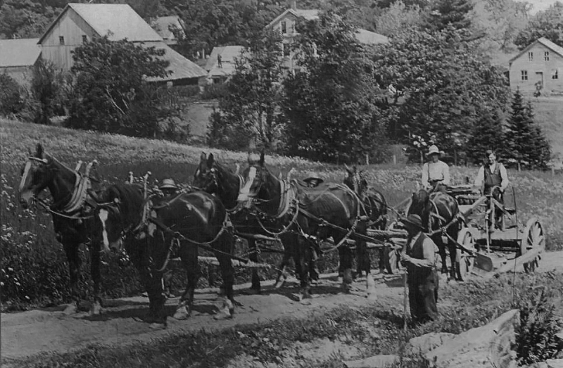
Construction de chemin | Knowlton's Landing
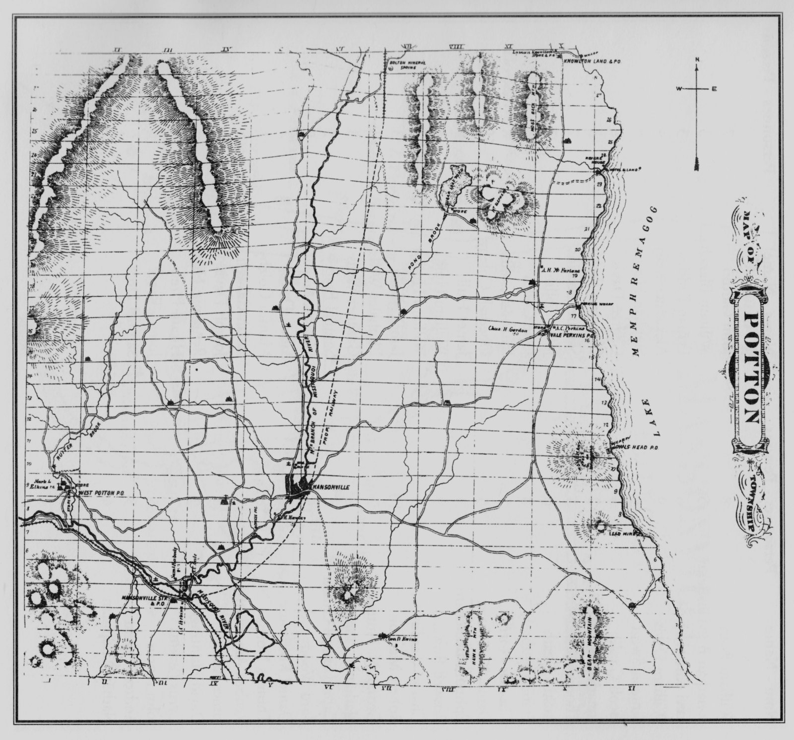
Carte routière 1881